
Typhoon Saudel has brought severe flooding to parts of southern and eastern China, forcing tens of thousands of people from their homes, disrupting schools and transport networks, and leaving authorities on alert for landslides and further flooding as torrential rain continues across several provinces.
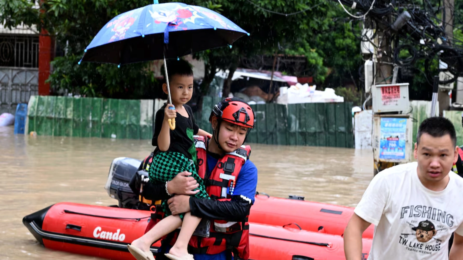
Fujian and Guangdong were bracing for another round of heavy rain on Friday after Saudel moved inland following its third landfall. Floodwaters submerged vehicles, entered homes and damaged buildings, while rescue workers were deployed to communities where roads had become impassable. In the city of Fuding in Fujian, firefighters were filmed carrying elderly residents through waist-deep water. In nearby Jinxi village, floodwaters brought down a three-storey brick house, according to footage verified by Reuters.
More than 83,000 people were evacuated in Fujian alone ahead of the latest landfall, while hundreds of thousands have been relocated across eastern China since Saudel first reached the coast in late August. Schools have closed in several cities, hundreds of transport services have been suspended, and authorities have shut construction sites and tourist attractions as the storm continues to affect a wide area.
The immediate emergency is unfolding against a much larger climate concern. The World Meteorological Organization has warned that the current El Niño is strengthening rapidly and is expected to become a very strong event before the end of 2026, with effects on rainfall and temperature patterns likely to continue into 2027.
The overlap between an unusually active typhoon season in China and an intensifying El Niño has placed renewed attention on how large-scale climate patterns can alter storm tracks and increase the risks faced by communities already saturated by repeated heavy rainfall.
Typhoon Saudel makes a third landfall in China
Saudel reached Zhangpu County in Fujian province at about 6:30 a.m. on Thursday, carrying maximum sustained winds of around 23 metres per second near its centre, according to the provincial meteorological observatory. It was the storm’s third landfall in China.
Saudel had previously struck the coast of Zhejiang province twice on August 28, first near Yuhuan and then near Wenzhou. At its earlier landfall, the typhoon carried substantially stronger winds, with maximum sustained speeds of about 35 metres per second near its centre.
After moving over land, the storm later regained strength before approaching Fujian, prolonging a weather system that has affected eastern China for days rather than passing quickly through one coastal region.
China’s National Meteorological Center said Saudel would continue moving westward while weakening, but its remaining moisture was expected to produce heavy to torrential rainfall across Fujian, eastern and northern Guangdong, southern Jiangxi and southern Hunan.
For emergency authorities, weakening wind speeds do not necessarily mean the danger has passed.
Once a tropical cyclone moves inland, prolonged rainfall can become the dominant threat, particularly in mountainous areas and places where rivers and soil are already saturated.
Flooding spreads through Fujian
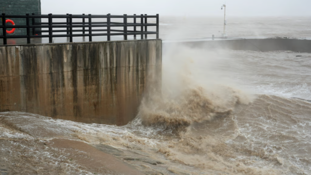
Some of the most severe flooding has been reported in Fujian, where emergency teams have been carrying out rescues, drainage operations and evacuations.
In Minhou County, near the provincial capital Fuzhou, photographs released by Chinese state media showed rescuers moving residents through flooded villages and emergency vehicles travelling along waterlogged roads.
In Fuding, Reuters verified footage showing rescue workers moving through deep water to reach residents. Jinxi, a mountainous tea-growing community, was also inundated, with strong floodwaters damaging residential buildings and causing one three-storey structure to collapse.
The disruption has extended well beyond individual communities. By Thursday morning, authorities in Fujian had:
evacuated more than 83,000 people, suspended 657 transport services, closed eight sections of major roads, halted work at 152 construction sites, closed more than 150 tourist attractions, and suspended classes in several affected cities.
Schools were closed in parts of Zhangzhou as well as in Fuzhou, Quanzhou and Ningde, while local governments increased their flood-control emergency response.
The scale of the precautions reflects concern that further rainfall could produce additional flash floods, mountain torrents and landslides.
China’s Ministry of Natural Resources has warned of a high risk of secondary disasters because recent storms have already pushed some rivers beyond warning levels and saturated low-lying areas.
An unusually active typhoon season for China
Saudel is part of a notably active period of tropical cyclone activity in the western Pacific.
Chinese climate officials said 24 typhoons had formed over the northwestern Pacific and South China Sea by September 1, more than 10 above the historical average for that point in the year. Seven had made landfall in China, also above average.
The country has experienced repeated spells of extreme rainfall through the summer. Chinese monitoring data cited by Xinhua show that 15 widespread rainstorm events occurred between June and August, while daily precipitation at 44 national meteorological stations broke historical records.
Saudel also follows Typhoon Narra, which brought heavy rain to Guangxi, Hainan and Guangdong in late August.
Chinese meteorologists expect another two to three typhoons could make landfall in, or significantly affect, the country during September, particularly along the eastern and southern coasts.
The repeated storms are increasing the risk of cumulative damage. A region may withstand one episode of heavy rain without major consequences, but subsequent storms can arrive when reservoirs are fuller, river levels are higher and hillsides are already saturated.
That can make flooding and landslides more likely even as individual storms weaken.
How El Niño is influencing the weather pattern
The timing of Saudel has drawn additional attention because the tropical Pacific is now experiencing an intensifying El Niño.
El Niño develops when surface waters in the central and eastern equatorial Pacific become unusually warm. The change affects atmospheric circulation and can alter rainfall, temperature and storm patterns across large parts of the world.
The WMO said on September 3 that El Niño is now firmly established and has an “exceptionally high likelihood of nearly 100%” of continuing through February 2027.
Sea surface temperatures in the central-eastern tropical Pacific have risen sharply. The Niño 3.4 index, a widely used measure of El Niño conditions, reached weekly values of about 2.2C to 2.6C above average between late July and mid-August.
Below the surface, ocean temperatures in some areas were more than 8C above average, providing a large reservoir of heat capable of sustaining the event.
The WMO expects El Niño to continue strengthening before peaking toward the end of 2026.
In a separate briefing, WMO Secretary-General Celeste Saulo said that if the current trajectory persists, the event could eventually become stronger than anything observed since systematic monitoring began several decades ago.
El Niño and Typhoon Saudel are linked, but the relationship is complex
Meteorologists in China have connected this year’s unusual typhoon tracks partly to El Niño.
Reuters reported that the Western Pacific subtropical high has been unusually strong and positioned farther north, a pattern experts associate with El Niño conditions. That configuration can steer tropical cyclones northwestward toward China’s eastern coastline.
Saudel’s path is unusual enough to draw particular attention. It became the third typhoon to affect Yuhuan in eastern Zhejiang in less than two months, an extremely rare sequence according to Chinese meteorological authorities.
However, climate scientists caution against using El Niño as a simple explanation for every individual storm.
The WMO explicitly notes that a very strong El Niño does not produce identical effects everywhere. Its influence changes by season and location, while other systems, including conditions in the Indian and Atlantic oceans, can strengthen, weaken, or alter the expected pattern.
El Niño is therefore part of the atmospheric background influencing this season, rather than a standalone explanation for every aspect of Typhoon Saudel.
Why the WMO warning has global implications
The international significance of the latest El Niño forecast extends far beyond China.
El Niño is one of the strongest natural influences on the global climate system. Depending on the region, strong events can increase the probability of drought, floods, extreme heat, or significant changes in seasonal rainfall.
The WMO expects above-normal temperatures across most land areas during the September-to-November period, while rainfall forecasts show a pronounced El Niño pattern.
Agriculture is particularly exposed because altered rainfall can affect planting seasons, crop yields, and water availability.
Energy systems can also come under pressure as heat increases demand for electricity while drought limits hydropower production in some regions.
Public-health risks can increase when extreme heat becomes more persistent or when flooding damages drinking-water systems and creates conditions favourable to some infectious diseases.
Governments and humanitarian organisations are therefore being encouraged to use seasonal forecasts to prepare before the strongest effects develop.
The WMO has increased coordination with national meteorological services and humanitarian organisations as the event strengthens.
El Niño is not caused by climate change
The relationship between El Niño and long-term global warming also requires careful interpretation.
El Niño itself is a naturally occurring climate phenomenon and is not caused by human-driven climate change, the WMO states.
However, El Niño now operates within a climate system that is substantially warmer than it was during comparable events decades ago.
That means natural warming associated with El Niño can combine with elevated background temperatures caused by greenhouse-gas emissions.
The powerful 2023-24 El Niño contributed to exceptionally high global temperatures, and WMO officials have warned that the current event could again have important implications for global temperature records.
Scientists therefore distinguish between the cause of El Niño itself and the broader warming conditions within which the event develops.
Further rain remains the immediate concern in southern China
For communities in Fujian and Guangdong, the global climate outlook is secondary to the immediate threat posed by further rainfall.
Authorities are continuing to monitor rivers, mountain areas and low-lying communities while emergency teams carry out evacuations and flood-control work.
Saudel is expected to weaken as it travels farther inland, but its rain bands can continue affecting provinces well away from the point of landfall.
China’s National Climate Center has also warned coastal provinces to prepare for additional tropical cyclones later in September.
The combination of repeated typhoons, saturated ground and unusually active weather across the western Pacific has made the remaining weeks of the season particularly important for emergency planners.
At the same time, the WMO’s latest El Niño assessment indicates that the climate pattern influencing weather well beyond China is still strengthening rather than fading.
For southern China, the priority is managing the floods already underway.
For governments elsewhere, the warning is that the wider climate conditions surrounding them could remain unusually volatile well into 2027.
Don’t forget to follow us on Facebook | Instagram | Twitter | LinkedIn to get the latest updates from Cape Town Tribune
Typhoon Saudel has brought severe flooding to parts of southern and eastern China, forcing tens of thousands of people from their homes, disrupting schools and transport networks, and leaving authorities on alert for landslides and further flooding as torrential rain continues across several provinces.
Fujian and Guangdong were bracing for another round of heavy rain on Friday after Saudel moved inland following its third landfall. Floodwaters submerged vehicles, entered homes and damaged buildings, while rescue workers were deployed to communities where roads had become impassable. In the city of Fuding in Fujian, firefighters were filmed carrying elderly residents through waist-deep water. In nearby Jinxi village, floodwaters brought down a three-storey brick house, according to footage verified by Reuters.
More than 83,000 people were evacuated in Fujian alone ahead of the latest landfall, while hundreds of thousands have been relocated across eastern China since Saudel first reached the coast in late August. Schools have closed in several cities, hundreds of transport services have been suspended, and authorities have shut construction sites and tourist attractions as the storm continues to affect a wide area.
The immediate emergency is unfolding against a much larger climate concern. The World Meteorological Organization has warned that the current El Niño is strengthening rapidly and is expected to become a very strong event before the end of 2026, with effects on rainfall and temperature patterns likely to continue into 2027.
The overlap between an unusually active typhoon season in China and an intensifying El Niño has placed renewed attention on how large-scale climate patterns can alter storm tracks and increase the risks faced by communities already saturated by repeated heavy rainfall.
Typhoon Saudel makes a third landfall in China
Saudel reached Zhangpu County in Fujian province at about 6:30 a.m. on Thursday, carrying maximum sustained winds of around 23 metres per second near its centre, according to the provincial meteorological observatory. It was the storm’s third landfall in China.
Saudel had previously struck the coast of Zhejiang province twice on August 28, first near Yuhuan and then near Wenzhou. At its earlier landfall, the typhoon carried substantially stronger winds, with maximum sustained speeds of about 35 metres per second near its centre.
After moving over land, the storm later regained strength before approaching Fujian, prolonging a weather system that has affected eastern China for days rather than passing quickly through one coastal region.
China’s National Meteorological Center said Saudel would continue moving westward while weakening, but its remaining moisture was expected to produce heavy to torrential rainfall across Fujian, eastern and northern Guangdong, southern Jiangxi and southern Hunan.
For emergency authorities, weakening wind speeds do not necessarily mean the danger has passed.
Once a tropical cyclone moves inland, prolonged rainfall can become the dominant threat, particularly in mountainous areas and places where rivers and soil are already saturated.
Flooding spreads through Fujian
Some of the most severe flooding has been reported in Fujian, where emergency teams have been carrying out rescues, drainage operations and evacuations.
In Minhou County, near the provincial capital Fuzhou, photographs released by Chinese state media showed rescuers moving residents through flooded villages and emergency vehicles travelling along waterlogged roads.
In Fuding, Reuters verified footage showing rescue workers moving through deep water to reach residents. Jinxi, a mountainous tea-growing community, was also inundated, with strong floodwaters damaging residential buildings and causing one three-storey structure to collapse.
The disruption has extended well beyond individual communities. By Thursday morning, authorities in Fujian had:
evacuated more than 83,000 people, suspended 657 transport services, closed eight sections of major roads, halted work at 152 construction sites, closed more than 150 tourist attractions, and suspended classes in several affected cities.
Schools were closed in parts of Zhangzhou as well as in Fuzhou, Quanzhou and Ningde, while local governments increased their flood-control emergency response.
The scale of the precautions reflects concern that further rainfall could produce additional flash floods, mountain torrents and landslides.
China’s Ministry of Natural Resources has warned of a high risk of secondary disasters because recent storms have already pushed some rivers beyond warning levels and saturated low-lying areas.
An unusually active typhoon season for China
Saudel is part of a notably active period of tropical cyclone activity in the western Pacific.
Chinese climate officials said 24 typhoons had formed over the northwestern Pacific and South China Sea by September 1, more than 10 above the historical average for that point in the year. Seven had made landfall in China, also above average.
The country has experienced repeated spells of extreme rainfall through the summer. Chinese monitoring data cited by Xinhua show that 15 widespread rainstorm events occurred between June and August, while daily precipitation at 44 national meteorological stations broke historical records.
Saudel also follows Typhoon Narra, which brought heavy rain to Guangxi, Hainan and Guangdong in late August.
Chinese meteorologists expect another two to three typhoons could make landfall in, or significantly affect, the country during September, particularly along the eastern and southern coasts.
The repeated storms are increasing the risk of cumulative damage. A region may withstand one episode of heavy rain without major consequences, but subsequent storms can arrive when reservoirs are fuller, river levels are higher and hillsides are already saturated.
That can make flooding and landslides more likely even as individual storms weaken.
How El Niño is influencing the weather pattern
The timing of Saudel has drawn additional attention because the tropical Pacific is now experiencing an intensifying El Niño.
El Niño develops when surface waters in the central and eastern equatorial Pacific become unusually warm. The change affects atmospheric circulation and can alter rainfall, temperature and storm patterns across large parts of the world.
The WMO said on September 3 that El Niño is now firmly established and has an “exceptionally high likelihood of nearly 100%” of continuing through February 2027.
Sea surface temperatures in the central-eastern tropical Pacific have risen sharply. The Niño 3.4 index, a widely used measure of El Niño conditions, reached weekly values of about 2.2C to 2.6C above average between late July and mid-August.
Below the surface, ocean temperatures in some areas were more than 8C above average, providing a large reservoir of heat capable of sustaining the event.
The WMO expects El Niño to continue strengthening before peaking toward the end of 2026.
In a separate briefing, WMO Secretary-General Celeste Saulo said that if the current trajectory persists, the event could eventually become stronger than anything observed since systematic monitoring began several decades ago.
El Niño and Typhoon Saudel are linked, but the relationship is complex
Meteorologists in China have connected this year’s unusual typhoon tracks partly to El Niño.
Reuters reported that the Western Pacific subtropical high has been unusually strong and positioned farther north, a pattern experts associate with El Niño conditions. That configuration can steer tropical cyclones northwestward toward China’s eastern coastline.
Saudel’s path is unusual enough to draw particular attention. It became the third typhoon to affect Yuhuan in eastern Zhejiang in less than two months, an extremely rare sequence according to Chinese meteorological authorities.
However, climate scientists caution against using El Niño as a simple explanation for every individual storm.
The WMO explicitly notes that a very strong El Niño does not produce identical effects everywhere. Its influence changes by season and location, while other systems, including conditions in the Indian and Atlantic oceans, can strengthen, weaken, or alter the expected pattern.
El Niño is therefore part of the atmospheric background influencing this season, rather than a standalone explanation for every aspect of Typhoon Saudel.
Why the WMO warning has global implications
The international significance of the latest El Niño forecast extends far beyond China.
El Niño is one of the strongest natural influences on the global climate system. Depending on the region, strong events can increase the probability of drought, floods, extreme heat, or significant changes in seasonal rainfall.
The WMO expects above-normal temperatures across most land areas during the September-to-November period, while rainfall forecasts show a pronounced El Niño pattern.
Agriculture is particularly exposed because altered rainfall can affect planting seasons, crop yields, and water availability.
Energy systems can also come under pressure as heat increases demand for electricity while drought limits hydropower production in some regions.
Public-health risks can increase when extreme heat becomes more persistent or when flooding damages drinking-water systems and creates conditions favourable to some infectious diseases.
Governments and humanitarian organisations are therefore being encouraged to use seasonal forecasts to prepare before the strongest effects develop.
The WMO has increased coordination with national meteorological services and humanitarian organisations as the event strengthens.
El Niño is not caused by climate change
The relationship between El Niño and long-term global warming also requires careful interpretation.
El Niño itself is a naturally occurring climate phenomenon and is not caused by human-driven climate change, the WMO states.
However, El Niño now operates within a climate system that is substantially warmer than it was during comparable events decades ago.
That means natural warming associated with El Niño can combine with elevated background temperatures caused by greenhouse-gas emissions.
The powerful 2023-24 El Niño contributed to exceptionally high global temperatures, and WMO officials have warned that the current event could again have important implications for global temperature records.
Scientists therefore distinguish between the cause of El Niño itself and the broader warming conditions within which the event develops.
Further rain remains the immediate concern in southern China
For communities in Fujian and Guangdong, the global climate outlook is secondary to the immediate threat posed by further rainfall.
Authorities are continuing to monitor rivers, mountain areas and low-lying communities while emergency teams carry out evacuations and flood-control work.
Saudel is expected to weaken as it travels farther inland, but its rain bands can continue affecting provinces well away from the point of landfall.
China’s National Climate Center has also warned coastal provinces to prepare for additional tropical cyclones later in September.
The combination of repeated typhoons, saturated ground and unusually active weather across the western Pacific has made the remaining weeks of the season particularly important for emergency planners.
At the same time, the WMO’s latest El Niño assessment indicates that the climate pattern influencing weather well beyond China is still strengthening rather than fading.
For southern China, the priority is managing the floods already underway.
For governments elsewhere, the warning is that the wider climate conditions surrounding them could remain unusually volatile well into 2027.
Don’t forget to follow us on Facebook | Instagram | Twitter | LinkedIn to get the latest updates from Cape Town Tribune